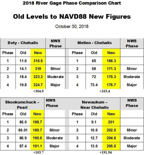
2018 River Gage information
The Chehalis River Basin Flood Authority has changed the vertical datum
on the following rivers in Lewis County:
1. Chehalis River at Doty
2. Chehalis River at Mellen St. Centralia
3. Skookumchuch Riverat Pearl St. Centralia
4. Newaukum River at Chehalis
The Guage information now reflects the given water level as height above mean sea level.
The information below represents this change. The Conversion information and historic flood crest
history dating back to 1971.
Click here to print 2018 river gage phase comparison chart
Click here to print Lewis County Rivers Flood Crest History
flood%20authority%20logo_sm.png

Click below for the