Lewis County Emergency Management working on updates to countywide disaster plan
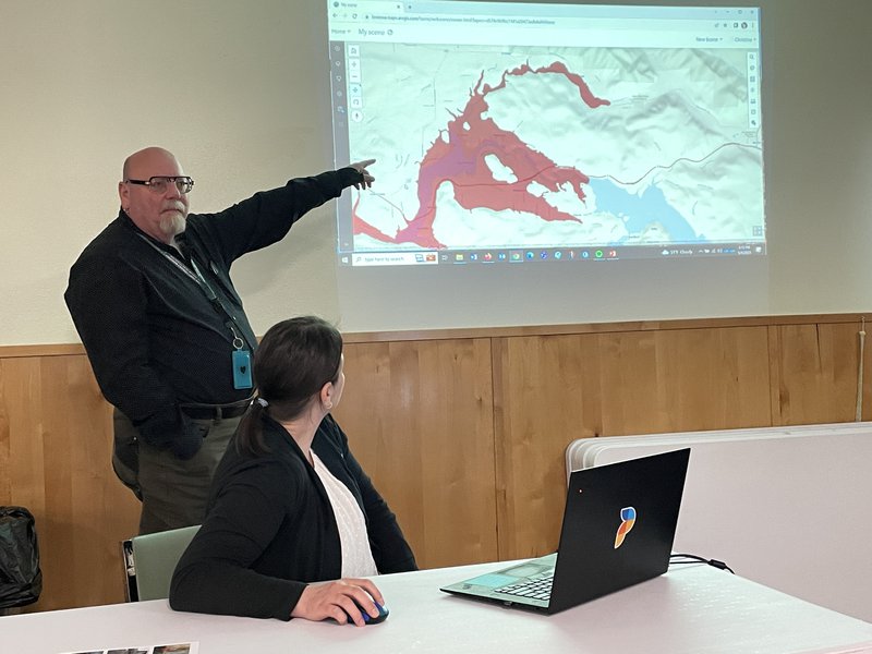
Lewis County Emergency Management Deputy Director Ross McDowell, left, points to potential hazard areas in Lewis County at a public meeting at the Mossyrock Community Center.
CHEHALIS – Lewis County Department of Emergency Management is updating the county’s Hazard Mitigation Plan, which identifies risks and ways to minimize damage by natural disasters. The plan was detailed at recent public meetings in Chehalis, Winlock, Packwood and Mossyrock.
The Hazard Mitigation Plan Story Map and Survey is a comprehensive interactive resource. You’ll find the latest on the developing plan, locate natural hazards in Lewis County and by using the Hazard Mapper, find what hazards may affect your home or community. The plan is designed to aid in setting local policies for hazard mitigation capability, while providing disaster response coordination among various agencies.
“This is something everyone should be doing at their homes – when you identify a problem, you work to fix that problem,” said Lewis County Emergency Management Deputy Director Ross McDowell. “Mitigation is how we can fix some of the impacts pertaining to flooding, earthquakes and other natural events.”
Consultants working with the county say an earthquake-caused lahar or mudflow from Mount Rainier or Mount Adams could affect eastern Lewis County. The consultants add that although a mudflow coming from Mount Rainer would most likely be stopped by the Mossyrock Dam, a breach in the dam could impact areas as far west as Toledo. Geologic models also show a lahar coming off Mount Adams could move northwest to the east end of Riffe Lake.
Find out how best to be prepared for the potential of a natural hazard by clicking here.